Posted on

Powerful Images

I ran across an article several months ago that immediately captured my attention. It was a photograph that sent chills down my spine. I said to myself, “Now that’s a very powerful image.”

I thought about the story behind the photograph and decided to write a blog about powerful and iconic images from World War II. Unfortunately, we can only include twenty-five photographs in this blog. However, there are hundreds if not thousands of other photographs that would fit into the theme of this blog. If interested, you can check out various web sites listed below to view some of the other photographs we did not include.

Please be warned that some of the images included in this blog are very disturbing.

We begin our photographic journey with the Hanukkah menorah in the window. It is the image that inspired me to write this blog.


Did You Know?

Did you know that nearly all forty of the original Washington D.C. boundary stones are hidden in plain sight? The capital city of the United States was originally a ten-mile by ten-mile diamond shape. These stones marked the boundaries of the city, and they are the oldest federally placed monuments in the United States.
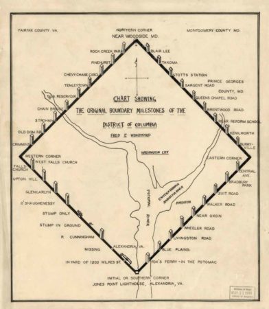
Chart showing the original boundary milestones of the District of Columbia. Map by Fred Woodward (c. 1906). PD-Expired copyright. Wikimedia Commons.

Andrew Ellicott was hired to chart out the new city, but the surveyor needed an assistant to read the stars to ensure the markers were placed accurately. Benjamin Banneker, an African American, was recommended to Ellicott. He questioned the competence of a Black man who had no formal schooling or scientific training. Faced with no alternatives, Ellicott hired the amateur astronomer to work alongside him. For six nights, Banneker lay on his back to record the stars and with those calculations, the first marker stone was placed at Jones Point. (You can see the stone through a window in the seawall of the 19th-century Jones Point Lighthouse.)
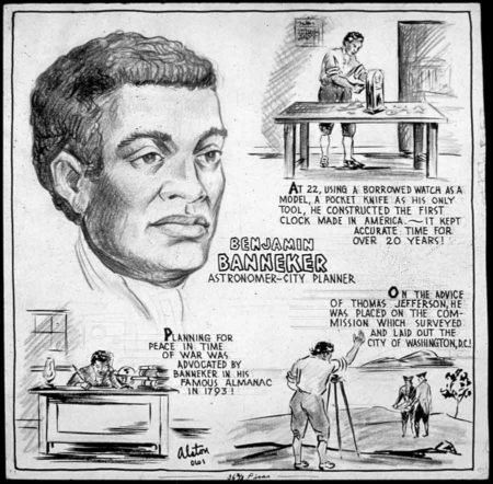
Benjamin Banneker, astronomer and city planner. Illustration by Charles Henry Alston (c. 1943). U.S. National Archives and Records Administration. PD-U.S. Government. Wikimedia Commons.

The stones are one foot square and three feet high. They were placed one mile apart and each is numbered according to its quadrant and location. Each side bears the inscription of either “Virginia” or “Maryland” depending on its border state. Other information inscribed on the sandstone markers were the words “Jurisdiction of the United States,” a mile number, the date the stone was erected (either 1791 or 1792), and a magnetic compass variance for the stone’s location. Thirty-six stones remain in their original place (some in severe deterioration as sandstone is not the best material for posterity) while three are replicas and one is represented by a simple plaque.
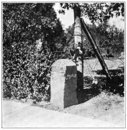
Boundary stone Northeast No. 2. Photo by anonymous (c. 1907). PD-Expired copyright. Wikimedia Commons.

Thomas Jefferson was secretary of state at the time, and he went on record as saying he did not believe Black and enslaved people were of the same standards as White people in terms of brains and physical abilities. Clearly, Jefferson had never met Mr. Banneker.
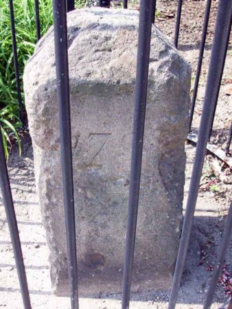
Boundary stone NE 2 between the District of Columbia and Takoma Park, Maryland. Photo by Bruce Anderson (August 2010). PD-CCA-Share Alike 2.0 Generic. Wikimedia Commons.

The Hanukkah Menorah

Hanukkah menorah on the windowsill of the Posner’s home in Kiel, Germany.

Read More Powerful Images

Posted on

Diplomatic Lessons and Warning Signs,

Fifteen years after the end of World War II, William L. Shirer published his epic book, The Rise and Fall of the Third Reich. I purchased the book almost forty years ago through the “Book of the Month Club”⏤remember that organization? (Believe it or not, BOMC still exists.) I just finished reading it and there were many topics from ninety-years ago that pertain to today’s world. Today’s blog captures one of those subjects.

American author and journalist, William L. Shirer. Photo by anonymous (c. 1961). PD-U.S. Government. Wikimedia Commons.

William L. Shirer (1904−1993) was an American journalist and war correspondent. He was an eyewitness to the rise of Adolf Hitler and Nazism during the 1930s. He started as a print journalist and worked for Universal Service until 1937 when he was fired from the William Randolph Hearst news company. Edward R. Murrow, European manager for CBS, immediately hired Shirer to open a bureau on the European continent. (Murrow worked out of the London office and wanted a correspondent located in Europe.) Shirer’s office was in Vienna but most of his reporting was done onsite from Paris, Berlin, and Rome. After Dunkirk, he personally followed behind the movement of German troops to report on the war. As the Nazis continued to pressure him in 1940 to report inaccurate information, Shirer suggested to Murrow that his tenure in Nazi territory was about over. Right about the same time, Shirer learned the Gestapo was developing a case against him for espionage which carried the death penalty. In December 1940, Shirer left Germany and did not return to Europe until 1945 when he covered the Nuremberg trials. Read More Diplomatic Lessons and Warning Signs,